Creative Fabric: Mapping New York’s Garment District
“Creative Fabric” is a Fashion Studies and Digital Humanities project that employs oral history, spatial mapping, and network analysis to explore New York’s current fashion production system through the microcosm of the Garment District. The project focuses on issues of sustainability in fashion and justice for workers in the fashion system.
Creative Fabric began in 2016 with informal interviews and conversations conducted with a group of Garment District business owners and workers, leading to the establishment of the New York Fashion Workforce Development Coalition (NYFWDC). Throughout the project, the research has explored the concept of “made in” and what it means to make fashion in New York City, as a process-embedded design discipline. The project has manifested through collaborations with Pratt Center’s Made in NYC initiative, a course titled “Made in NYC: Narratives of City, Identity & Affect,” knowledge sharing with Pratt’s Center for Teaching and Learning through Iteratio, and collaboration with graduate assistants from the School of Information, Historic Preservation, and the School of Design.
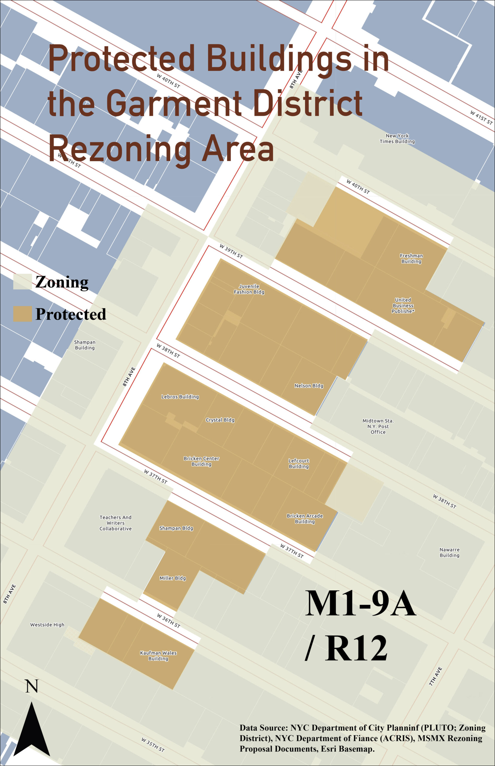
Recent work has centered on the rezoning in the Garment District, which took place as part of the Midtown South Mixed-Use Plan (MSMX) in 2025. The rezoning threatened further displacement of hundreds of legacy businesses and thousands of workers, many of whom were unaware of the rezoning. Through door-to-door outreach and community organizing, the plan was modified to include a protected area for fashion manufacturing and significant promised investment from the City in the District. The work presented focuses on mapping and visualizations to facilitate further community engagement.
-
 Tessa Maffucci is a teacher, researcher and organizer advocating for ethical fashion economies. She teaches fashion history and theory focusing on the intersections of fashion and labor, with an emphasis…