Building a collective story of North Brooklyn heat experience
By Yuliya Dzyuban and Lisa Bloodgood
Cities are rapidly warming due to the combined effects of climate change and the urban heat island effect, yet heat exposure varies dramatically across neighborhoods.
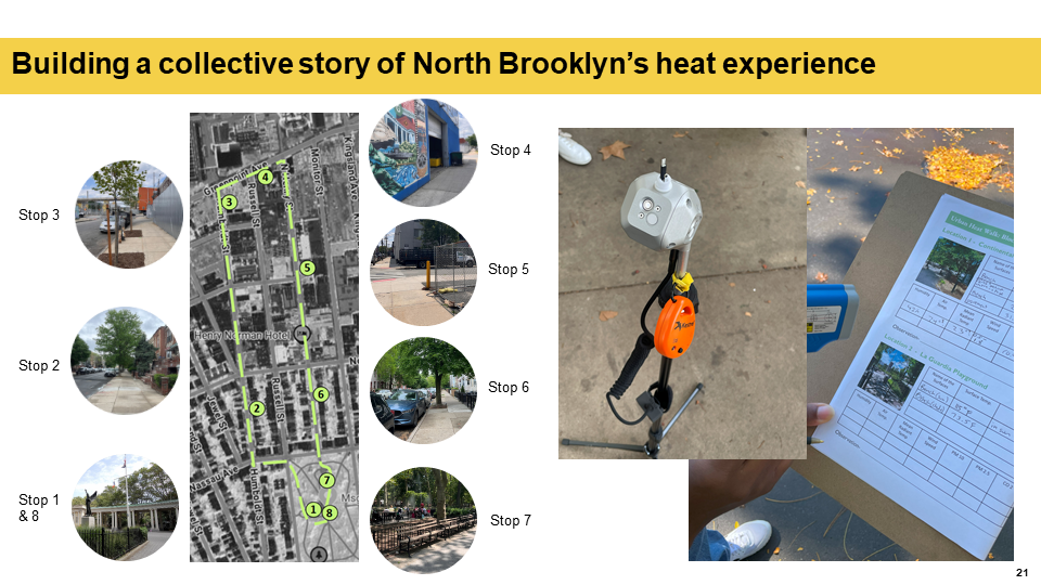
Many cities use coarse satellite derived surface temperature data to represent heat exposure, and are limited in their ability to represent conditions experienced by the individuals on the street. To address this gap, there is a need for street-level data that reflects how residents actually experience heat in their daily lives. Over the summer, we lead a series of participatory “urban heat walks” in the North Brooklyn communities of Greenpoint and Williamsburg in New York City. The events combined mobile microclimate monitoring with community participation, storytelling, and reflection.
Participants walked a pedestrian route while real-time air temperature, humidity, wind, and radiation data were collected. At selected stops, participants completed thermal comfort surveys and engaged with short character-based scenarios that encouraged them to consider how extreme heat affects others beyond their own personal experiences.
These characters represented people, trees, birds, or other urban life, reinforcing a more-than-human perspective on heat vulnerability. The walks concluded with facilitated discussions linking lived experience to environmental justice, infrastructure, and urban ecology.
This project was supported by the Taconic Fellowship, and was conducted in partnership with North Brooklyn Parks Alliance (NBK Parks), an organization with a longstanding commitment to improve the quality of green space in North Brooklyn. NBK Parks guided key implementation decisions, including selecting a walk route, participant outreach through trusted community networks, and helped structure activities to encourage meaningful, resident-led input.
Students in the Spring 2026 Microclimate Assessment for Urban Design course offered by the Pratt’s Sustainable Environmental Systems Program are synthesizing collected data to inform NBK Parks 100 year tree succession plan in McGolrick park, and support advocacy towards tree stewardship in the Industrial Business Zone.
-
 My work contributes to developing solutions targeting extreme heat in urban areas to enhance resilience and livability. My research has taken me to some of the hottest cities globally, including…