 The Spatial Analysis and Visualization Initiative (SAVI) at Pratt worked on data analysis and mapping for the Museum of the City of New York’s (MCNY) first permanent exhibition, New York at Its Core, which opened to the public in November 2016.
New York at Its Core presents the dramatic 400-year history of New York City as well as a high-tech look at the future. The exhibition challenges the notion that the city’s identity and culture can be drawn from any one source. It paints the picture of the urban experience through the portrayal of the artifacts, data, and dynamic visualizations that reveal intractable points of change in New York City history.
SAVI, led by director Jessie Braden, worked with MCNY curators for six months to analyze spatial data and develop stories for the Future City Lab, which is one of three galleries in the exhibition and covers the years 2000-2050.
SAVI staff member Case Wyse (M.S. Urban Environmental Systems Management ‘16) and graduate assistants Adriana Beltrani (M.S. City and Regional Planning ‘17), Jonathan Marable (M.S. City and Regional Planning ‘17), Sarita Rupan (M.S. Sustainable Environmental Systems ‘17), and Ahmad Shaibani (M.S. City and Regional Planning ‘17) also worked on the project, which resulted in nearly 100 maps around five themes: Living Together, Housing a Growing City, Making a Living, Getting Around, and Living with Nature.
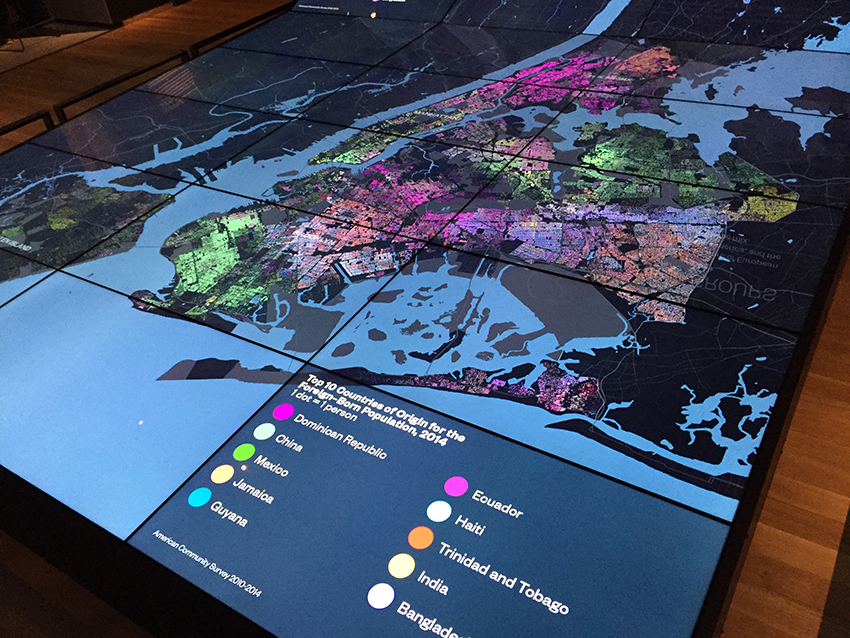
The maps and statistics are displayed on a 16’ by 12’ curved screen, allowing visitors to see, from the regional scale to street scale, the extent to which characteristics such as population diversity or business growth define the city’s neighborhoods. The exhibition has received media coverage in outlets including The New York Times, The Wall Street Journal, The Architect’s Newspaper, City Lab, and Untapped Cities.
Learn more about SAVI and New York at Its Core.